
Akakus Fm
Type Locality and Naming
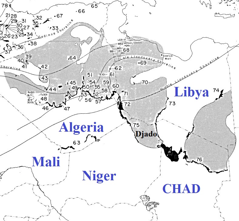
Desio, 1936a, 1936b. Origin from Jabal Akakus in the Ghat area, southwest Libya, 100 km N of Takarkhouri Pass. However, this description was incomplete, and a replacement type section was established by Klitzsch (1969) from an area to the south of Ghat where a complete section is present. (Fig. 2)
[Figure 1: Index map of North African Silurian outcrops (black) and subsurface (grey) (Source: Berry et al., 1973)]
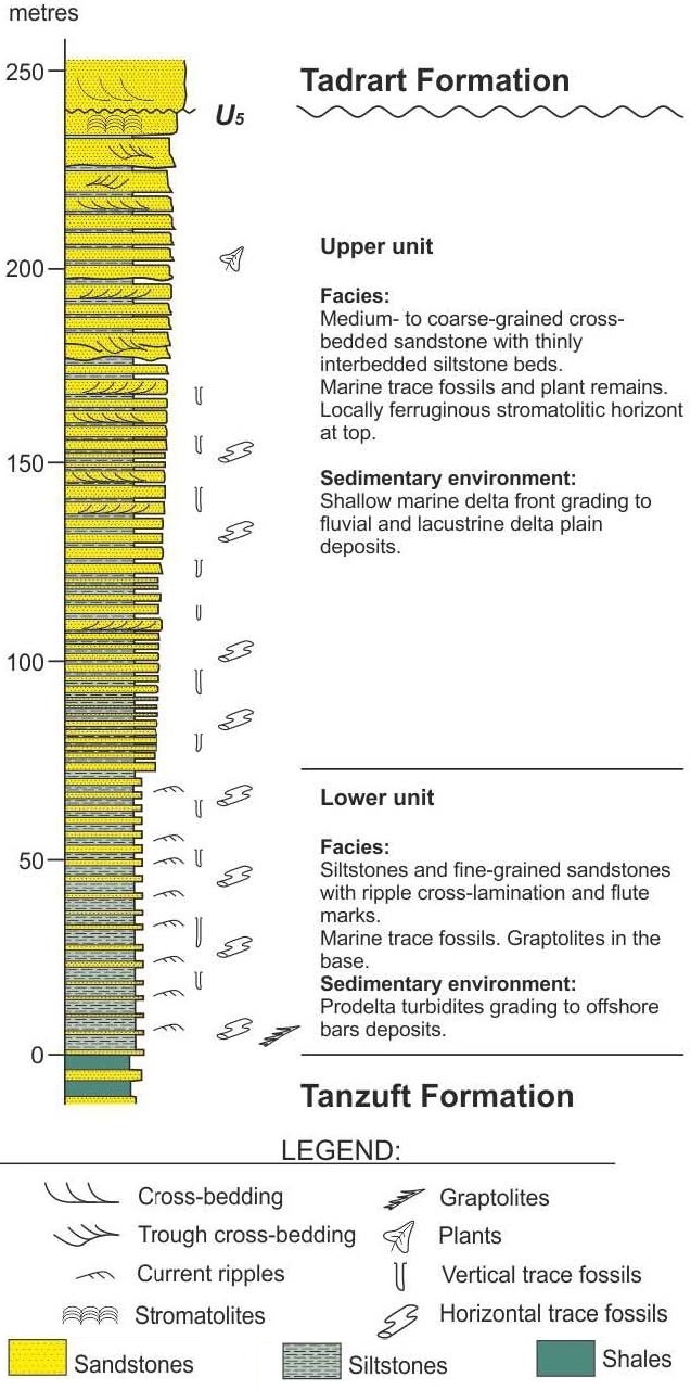
[Figure 2: Stratigraphic column of the Akakus Formation at Klitzsch’s Type Locality in Libya (Source: Shalbak, 2015)]
References: Desio, 1936a, 1936b; Plauchut & Faure, 1959; Jacqué, 1963; Freulon, 1964; Klitzsch, 1969; Massa & Jaeger, 1971; Berry et al., 1973; Lababidi et al., 1985; Mergl et al., 2001; Shalbak, 2015; Hallett, 2002, 2016;
Synonym: The former name of the formation was spelled “Acacus”. The spelling was modified to its current form by Hallet (2002) after verifying the official name records of localities in Libya; Equivalent(s): "Formation des Alternances Grèso-Argileuses" [Sandy-shale Formation] in the Ghadames Basin of Libya. Lower part of "Grès Supérieurs de Tassili".
Lithology and Thickness
Mainly composed of fine-grained micaceous sandstones and siltstones, outcropping in both flanks of the Djado Basin. Freulon (1964) describes it as "Generally quite fine sandstones, often with cross-bedded stratification and ferruginous cement. Pelitic levels show numerous Harlania". Freulon (1964, page 105) states a thickness of about 100 meters in the Djado. The total thickness of the Silurian (Tanzuft & Akakus) varies, ranging between 150 to 300 m in the western Djado Basin. Thickness is more reduced along the eastern margin of the Djado Basin, with a maximum of 120 m, but Silurian rocks may be also totally absent.
Relationships and Distribution
Lower contact
Disconformable contact with the underlying Tanzuft Fm
Upper contact
Disconformable contact with the overlying Tadrat Fm
Regional extent
Djado Basin
GeoJSON
Fossils
Massa and Jaeger (1971) cited the following fossils, primarily ichnofossils, from the formation: Harlania (=Arthrophycus), Cubichnia, Risophycus bilobatus, Palaeophycus, Pelecypodichnis, Cruziana furcifera, Cruziana irregularis, Dimorphichnus, Acutiramus, several mollusks, and trilobite fragments.
Age
Depositional setting
Shallow water. Massa and Jaeger (1971) suggested that the fossils indicated a marine or lagoonal environment of deposition
Additional Information